We thought residents would like to learn more about the road improvements planned for the city centre and in some cases already begun. So here are links for the main projects as found on the Better Roads website of Liverpool City Council.
Liverpool City Centre Connectivity Scheme Phase One:
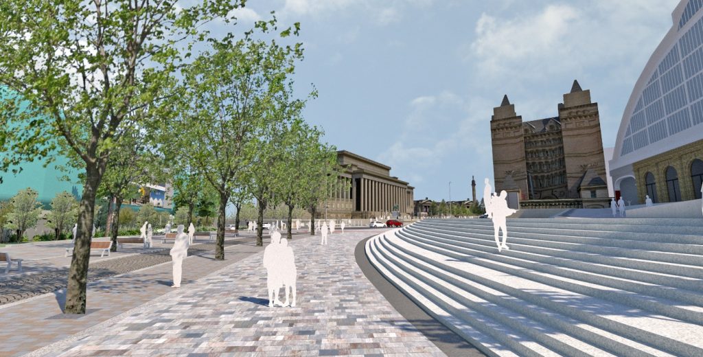
- Lime Street: Creating a new gateway into the city from Liverpool Lime Street Station and a new events space for St George’s Plateau.
- Victoria Street and Tithebarn Street: Enhancing the area for public use and improving connectivity through the city by introducing a new cycle link between Lime Street and the Waterfront.
- Brownlow Hill: Enhancing the area for public use and introducing of new cycle link from Liverpool Lime Street to the Knowledge Quarter.
- Moorfields: Improving the footways and introducing new trees to enhance the area and the entrance into Moorfields Station.
- City Bus Hub: Creating a new bus layover with welfare facilities in Old Haymarket for buses leaving Queen Square bus station so reducing congestion and pollution in the city centre.
- City Coach Park: Building an off-street parking facility and rest area for coach drivers.
- Canning Dock Bridges: Building four new bridges to link Salthouse Quay with Mann Island and opening up land for future development.
- The Strand: Improving links for pedestrians and cyclists between the city centre shopping areas and the waterfront leisure district by reassigning existing road space along The Strand.
Liverpool City Centre Connectivity Scheme Phase Two:
Phase Two of the Liverpool City Centre Connectivity Scheme will build two new roads off Waterloo Road and Regent Road to the north west of the city centre. The primary purpose of the scheme is to address current and anticipated future congestion in the area, and improve accessibility to the waterfront area with its re-positioned and improved Isle of Man Ferry Terminal.
The northern road runs from the re-positioned Isle of Man ferry terminal to Waterloo Road, a key route running north-south between the city centre and northern suburbs. The southern road provides a connection between Princes Parade and the Leeds Street/Great Howard Street/King Edward Street junction.
- Phase 1 – Wood Street, Fleet Street, Slater Street, Colquitt Street.
- Phase 2 – Bold Street and Seel Street.
As part of the proposals there are opportunities to improve the area:
- Upgrading the pavements and roads.
- Installing new and improved seating, bike racks, bins and lighting.
- Improving safety for pedestrians and cyclists.
- Reversing the one-way traffic system on Seel Street, running from Gradwell Street to Berry Street.
- Closing Seel Street between Colquitt Street and Slater Street at night time.